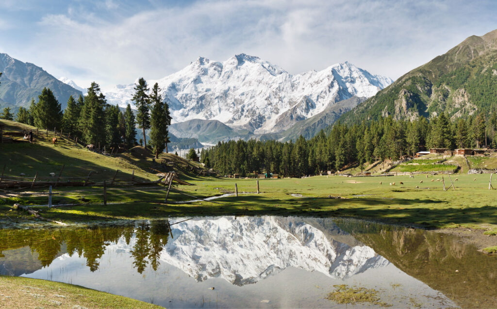
Fairy Meadows means a valley of fairy tales and was named by German mountaineers as Märchenwiese, Locals call it Joot that is an area of grassland near one of the base camp sites of Nanga Parbat, located in Diamer District in Gilgit-Baltistan region in Pakistan. It is located at an altitude of about 3,300 metres (10,800 ft) above sea level, it serves as the launching point for mountaineers summiting Nanga Parbat by the Raikot side. In 1995, the Government of Pakistan declared Fairy Meadows a National Park.
Fairy Meadows Tours & Trekking
Fairy Meadows is approachable by a fifteen kilometer-long jeepable trek starting from Raikot Bridge on the Karakoram Highway and leading to the village of Tatto and from there is about 2 ½ hours walk Fairy Meadows. The dangerous and narrow gravel mountain road from the bridge to the village is only open to locals, who provide transportation to visitors. In 2013, the World Health Organization declared it the second-deadliest road on the planet. From Tatto onward one can also hire a pony if can’t make this hike.[8][9] The grassland is located in the Rakhiot valley, at one end of the Raikot glacier which originates from Nanga Parbat and feeds a stream that finally flows into River Indus.
The six-month tourist season at Fairy Meadows starts in April and continues until the end of September. Tourists come to retreat the summer heat of the plains of Pakistan across the country. The main attraction of this place other than the meadows itself is the view of Nanga Parbat Mountain. Tourists usually hike to the base camp of the mountain from Fairy Meadows. There is superb view of Nanga Parbat (8125m) from Fairy Meadow cottages.